Painted Desert

The Petrified Forest and the Painted Desert are basically in the same park. You enter one from the south and one from the north. Both Visitor Centers are worth a stop, though the one at the southern end is better because they have a short trail where you can see petrified logs up close.

The Painted Desert was crazy spectacular!  I'm really happy I visited.   The colors were amazing; blues, purples, pinks, tans, just like someone took a paintbrush to the hills.  Beautiful.


There was a fellow with camels there - he was busy talking to a lady so I didn't stay to find out what his deal was, but the camels seemed to feel right at home ther ein the desert.


After a wonderful day exploring here,
I got back on the Highway and headed to Gallup, New Mexico.

Petrified Forest

From Holbrook, I headed to the southern end of the Petrified Forest and Painted Desert.  The Petrified Forest is in the southern end of the park and the Painted Desert is in the northern end. If I had it to do again, I'd enter the Painted Desert at the northern tip right off Hightway 40/Route 66, but for some reason, the guidebook didn't say that was possible and I ended up driving the full length of the park 3 times. 

I parked at the lower end, right outside the park, in a small FREE Crystal Forest Shop campground run by tourist shop there.  The lady there was nice, and said as long as I had a toilet, I could park there free for up to 10 days. 

HOWEVER, for some weird reason (people without toilets?) the FLIES were CRAZY!  I'm talking 50 flies if I opened my van door for 2 minutes. I wasn't too happy about staying there, honestly, due to the flies. Otherwise, it would have been fine and I bet the stars would have been magnificent that night!

I left my ice chest and chair in my camping spot, the one under the big tree she suggested that had shade all day, and headed up the 20-something mile road to see the Petrified Forest, then the Painted Desert at the other end. Once I got up at the northern end of the park, I saw the sign that told me I could get back on Hwy 40 there!

I looked at the map and it was closer than going all the way around. If I'd not left my ice chest and chair, I could have just hopped onto the highway there, but the chair is special to me, so I drove back down to retrieve it. Then I drove back UP and stopped at the points I'd passed before due to the number of tourists in the parking lots. The park is self-guided, with pull-outs at the important points. It was pretty busy, so I'd passed some points, and was happy to have the opportunity to stop and see the ones I'd missed.
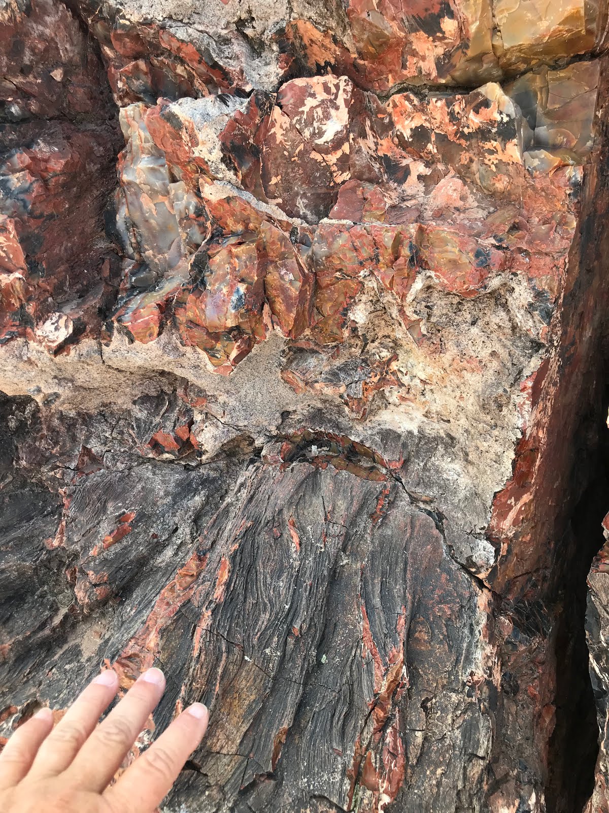
A beautiful specimen of petrified wood at the Visitor Center

Always look UP!
YIKES!


The best place to see the petrified logs up close is the Visitor Center Trail


Campsite is at  GPS: 34.79245, -109.890915

Wigwam Hotel

Next stop was the Wigwam Hotel in Holbrook. 
It was like a walk back into my childhood. 


A very cool piece of petrified log


The sign says:

Dear Mr. Paul Lewis,
It is my pleasure to inform you that the
Wigwam Village ... was listed on 
the National Register of Historic Places on May 2, 2002.
As you know, the National Register is the official listing
of the Nation's cultural resources worthy of preservation.
Congratulations!
Sincerely,
Christine M. Vlahistorm
National Register Coordinator/Historian
Arizona State Historic Preservation Office

The JACKRABBIT

Here It Is!
I arrived at the Jackrabbit, and met a couple from Eugene Oregon.
They were doing Route 66 in a convertible, and graciously offered to take my photo on the jackrabbit!


The shop was closed, so I got back on Route 66 and headed for Joseph City.


Standin' On The Corner . . .

Next stop was Winslow, Arizona!
The first thing I did was gas up,
then stopped at a carwash to wash the dust off my van
so I could open the door without getting slimed.

Then I asked a friendly policeman, 
"Where's the famous corner?"
He directed me, 
and
here I am "standin' on the corner."

(There are signs directing people as you get closer, btw)


This was fun.
I must have taken about 50 photos
with my iPhone propped up on a lamp post,
trying to get a good shot.

And here's the Flat Bed Ford! 
You can actually see it in the previous photo in the window reflection.
There was a funny old guy sitting on the corner,
watching all the silly people stopping,
getting their photo taken,
then leaving.
I counted at least 5 in the 15 minutes I was sitting there.
Must be real entertainment when you live 
in a town as small as Winslow!


After taking my photo,
I found breakfast in a mom and pop joint 
at the end of Route 66 before getting back on the highway.
Sadly, I forgot to take a photo or get the name.
But it was pretty good corned beef hash and eggs!

On to the JACKRABBIT!

Happy Trails,
Annie

Twin Arrows

Since I was unable to camp at Walnut Canyon, I drove until I was out of what seemed to be the smoke zone. I thought I'd camp at the old Twin Arrows, and was happy so find a brand new casino across the street, where I was able to spend the night.

I can still see the smoke in the distance. It's headed this way in the photo, and when I woke up next morning, I could smell smoke.  When I drove back through a couple of days later, it was smoky here.

This is a friendly place to boondock. I called and asked and was told it was fine to camp in the parking lot if I was going to play. I spent maybe $60 playing the slots and having dinner. I had a good time, so it was worth it.  Be sure and sign up at the Customer Service area, because you get to spin a wheel and get $$$ free play.  I won $50 free play and spent several hours playing the penny slots on that free play.  FUN!

I had the buffet for dinner, and frankly, it wasn't worth the price. I've had MUCH better buffet meals at other casinos.  If I were to do it again, I'd stay here, but would either eat in the van or find food before arriving.

The REAL Twin Arrows
The above photo is all I could see of the REAL Twin Arrows in the dark.

Next morning I can see the smoke approaching
The Casino parking lot
I headed out early and stopped at a rest stop a few miles out of town to make coffee and wait for the sunrise.


Next stop was the JACKRABBIT!

Love,
Annie

Little Colorado River Gorge and Walnut Canyon

One of the places I stopped was at this Little Colorado River Gorge Interpretive Center. There is a donation fee - and lots of Native American art and jewelry sold here as well.  It was certainly worth the stop, and the canyon was nearly as breathtaking as the Grand Canyon itself.

Those green specks at the bottom are large trees.


See the people at the top to get perspective of how deep this canyon is.

The Four Sacred Mountains:


Here is a map of other Interpretive Sites and Monuments worth seeing.


From here,  continued on toward Flagstaff where I planned to stop for a week or so and camp with some van friends. I was shocked to see tons of smoke billowing over the valley as I drove in and my heart sank. I got online and learned that the Forest Service was doing controlled burns to help stop a wildfire in the area.  This changed my plans, as I cannot tolerate smoke with my MCS.

I found a mail lady and asked her if she knew anything about the fires and if she thought Walnut Canyon would be affected, as that was my next stop. She thought I'd be ok there.

I headed further on to Walnut Canyon. When I arrived, I spoke with the Interpretive Center employees, who told me they expected the smoke would reach them by afternoon.  

Bummer.
Super Bummer.

I went ahead and scoped out camping for next trip.
As you drive toward the Interpretive Center, just before you arrive, you will cross a state road that goes in both directions.  You can turn left OR right and camp anywhere off that road.  I found many camp spots but they were full!  Probably people escaping the smoke!  The few that were left were impossible for my Toyota Sienna to access because of very deep ruts in the road. I would have bottomed out had I attempted access. However, if you have higher clearance, you'd probably be ok.  The camp spots ranged from forested to meadows and were quite pretty.  Here is a photo I took of one that I managed to get into. Unfortunately, there was a HUGE pile of trash left by previous campers; sofa parts, boxes, metal, bricks, just all sorts of things. But the meadow itself was very pretty due to the recent rains.


I will definitely be back to camp here!

The lady was right, by the way. When I drove back through 2 days later, this area was inundated with heavy smoke!  

GPS:   35.177753, -111.50106


Tusayan Museum and Ruins

On my way out of the Grand Canyon,
I stopped to visit the Tusayan Ruins and the Museum.

Cohonina and ancestral Pueblo (Kayenta Anasazi) people lived in this area in prehistoric times. The ancestral Puebloans built Tusayan about AD 1185.  Excavation of the Tusayan ruins was conducted in 1930 under the direction of Harold S. Gladwin and the staff of the Gila Pueblo of Globe, Arizona. They named it Tusayan following the Spanish nomenclature for the district. The exact meaning of the word has been lost.   The ruin is unique in that no attempt was made at reconstruction, and portions of the ruin were deliberately left unexcavated. It is one of the most heavily visited archeological sites in the National Park system (from the museum notes).

Living Quarters


Large Kiva
Display of Corn, Beans, and Squash growing.

Arches to Salt Lake City

It was about a 4 hour drive to Salt Lake City and by the time I got there, I was so tired, I called my son Cameron and asked if he could boo...